
| Visitors | New Residents | Events | Business Directory | Civic Info | Airport Info | Contact Us |
Rental Properties
Associated Companies
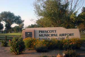
Prescott Municipal Airport
Ernest A. Love Field [KPRC]
 Service to Los Angeles, California
Horizon Air provides daily flights to and from Los Angeles International Airport (LAX). For more information, flight schedules, ticket pricing and reservations please visit the Horizon Air Website or call Horizon Air Reservations at Toll Free (800) 547-9308
Service to Denver, Colorado; Farmington, New Mexico; and Ontario, CaliforniaGreat Lakes Airlines provides daily direct flights to and from Denver, Colorado (DEN); Ontario, California (ONT); and Farmington, New Mexico (FMN). For more information, flight schedules, ticket pricing and reservations please visit the Great Lakes website or call Great Lakes Reservations at 800-554-5111.
Prescott Municipal Airport's (PRC) strategic location provides pilots an incredible 350 days of Visual Flying Rules, with 100-mile visibility, clear skies and light surface winds. Ernest A. Love Field at PRC has been engineered for safety and convenience. Takeoffs and landings couldn't be easier: the 150-foot wide primary runway is 7,600 linear feet of asphalt, and PRC's parallel and connecting taxiways traverse all three of the airfield's runways.
Prescott Municipal Airport is also the home of the FAA Regional Flight Services Station, which briefs pilots 24 hours a day, 365 days a year with flight plans, weather and airport conditions statewide. Conveniently located at 6546 Crystal Lane just seven miles north of Prescott near Highway 89 and Highway 89A, PRC provides easy access to the tri-city region of Prescott, Chino Valley and Prescott Valley.
Location
- FAA Identifier: PRC
- Lat/Long: 34-39-16.1000N / 112-25-10.5000W
34-39.268333N / 112-25.175000W
34.6544722 / -112.4195833
(estimated) - Elevation: 5045 ft. / 1537.7 m (surveyed)
- Variation: 13E (1995)
- From city: 7 miles N of PRESCOTT, AZ
- Time zone: UTC -7 (year round; does not observe DST)
- Zip code: 86301
Airport Operations back to the top
- Airport use: Open to the public
- Activation date: 04/1940
- Sectional chart: PHOENIX
- Control tower: yes
- ARTCC: ALBUQUERQUE CENTER
- FSS: PRESCOTT FLIGHT SERVICE STATION
- NOTAMs facility: PRC (NOTAM-D service available)
- Attendance: 0600-2000
- Pattern altitude: TPA FOR LIGHT ACFT ALL RUNWAYS 1000 FT. TPA FOR LARGE ACFT, ALL TURBO PROP/JET AND HIGH PERFORMANCE ACFT ALL RUNWAY 1500 FT.
- Wind indicator: lighted
- Segmented circle: yes
- Lights: DUSK-DAWN AFTER 2200 ACTVT MIRL RY 03R/21L - CTAF. ACTVT MIRL RY 12/30 FREQ 128.75.
- Beacon: white-green (lighted land airport)
- Fire and rescue: ARFF index A
- Airline operations: CLSD TO ACR OPNS WITH MORE THAN 30 PSGR SEATS EXCP PPR CALL AMGR (928) 777-1114.
IAPs - Instrument Approach Procedures back to the top
- ILS/DME RWY 21L download (318KB)
- RNAV (GPS) RWY 21L **CHANGED** download (312KB)
- GPS RWY 12 download (246KB)
- VOR RWY 12 download (288KB)
- NOTE: Special Alternate Minimums apply download (19KB)
- NOTE: Special Take-Off Minimums apply download (46KB)
Other nearby airports with instrument procedures: back to the top
- KSEZ - Sedona Airport (33 nm E)
- KFLG - Flagstaff Pulliam Airport (47 nm NE)
- KPAN - Payson Airport (59 nm SE)
- KDVT - Phoenix Deer Valley Airport (60 nm S)
- 40G - Valle Airport (61 nm N)
Airport Communications back to the top
- CTAF: 125.3
- UNICOM: 122.95
- ATIS: 127.2
- WX ASOS: PHONE 928-717-1287
- PRESCOTT GROUND: 121.7 [0600-2200]
- PRESCOTT TOWER: 125.3 257.9 [0600-2200]
- APCH/DEP SERVICE PROVIDED BY ALBUQUERQUE ARTCC ON FREQS 128.45/298.9 (PRESCOTT RCAG).
Nearby radio navigation aids back to the top
| VOR radial/distance | VOR name/th> | Freq | Var |
|---|---|---|---|
| DRKr120/4.2 | DRAKE VORTAC | 114.10 | 14E |
Airport Services back to the top
- Fuel available: 100LL JET-A
- FUEL AVBL 0600-2000 CALL (928) 771-1150. FUEL AVBL 2000-0600 MEDICAL/LAW ENFORCEMENT FLIGHTS ONLY ON CALL OUT BASIS (928) 445-3131.
- Parking: tiedowns
- Airframe service: MAJOR
- Powerplant service: MAJOR
- Bottled oxygen: NONE
- Bulk oxygen: NONE
Runway Information back to the top
Runway 3R/21L
- Dimensions: 7550 x 150 ft. / 2301 x 46 m
- Surface: asphalt/porous friction courses, in good condition
- Weight bearing capacity: Single wheel: 63000 lbs
- Double wheel: 80000 lbs
- Double tandem: 100000 lbs
- Runway edge lights: medium intensity
| Runway | 3R | 21L | |
|---|---|---|---|
| Latitude: | 34-38.745288N | 34-39.680430N | |
| Longitude: | 112-25.725345W | 112-24.731910W | |
| Elevation: | 5032.9 ft. | 4960.1 ft. | |
| Gradient: | 1.0 UP | 1.0 | |
| Traffic Pattern: | right | right | |
| Runway heading: | 028 magnetic, 041 true | 208 magnetic, 221 true | |
| Displaced Thresh.: | 724 ft. | no | |
| Markings: | nonprecision, in good condition | precision, in good condition | |
| Visual Slope: | 4-light PAPI on left (4.00 degrees path) | 4-light PAPI on left (3.00 degrees glide path) | |
| Approach Lights: | MALSR: 1,400 foot medium intensity approach lighting system with runway alignment indicator lights | ||
| Runway end lights: | yes | yes | |
| Touchdown point: | yes, no lights | yes, no lights | |
| Instrument approach: | ILS/DME | ||
Runway 3L/21R
- Dimensions: 4846 x 60 ft. / 1477 x 18 m
- Surface: asphalt, in good condition
- Weight bearing capacity: Single wheel: 12500 lbs
- Runway edge lights: medium intensity
- Operational Restrictions: RY 03L/21R CLSD 2200-0600.
| Runway | 3L | 21R |
|---|---|---|
| Latitude: | 34-39.389428N | 34-39.989708N |
| Longitude: | 112-25.226915W | 4937.7 ft. |
| Elevation: | 5017.1 ft. | 5044.9 ft. |
| Gradient: | 0.9 | 0.9 |
| Traffic Pattern: | left | left |
| Runway heading: | 124 magnetic, 137 true | 304 magnetic, 317 true |
| Displaced Thresh.: | 150 ft. | no |
| Visual Slope: | 2-light PAPI on left (3.00 degrees glide path) | 2-light PAPI on left (3.00 degrees glide path) |
| Touchdown point: | yes, no lights | yes, no lights |
Runway 12/30
- Dimensions: 4408 x 75 ft. / 1344 x 23 m
- Surface: asphalt, in good condition
- Weight bearing capacity: Single wheel: 12500 lbs
- Runway edge lights: medium intensity
| Runway | 12 | 30 |
|---|---|---|
| Latitude: | 34-39.164295N | 34-38.637042N |
| Longitude: | 112-25.677960W | 112-25.073272W |
| Gradient: | 0.8 UP | 0.8 UP |
| Traffic Pattern: | left | right |
| Runway heading: | 028 magnetic, 041 true | 208 magnetic, 221 true |
| Displaced Thresh.: | 811 ft. | no |
| Markings: | nonprecision, in fair condition | basic, in fair condition |
| Visual Slope: | 2-light PAPI on left (3.00 degrees glide path) | 2-light PAPI on left (3.00 degrees glide path) |
| Runway end lights: | yes | yes |
| Touchdown point: | yes, no lights | yes, no lights |